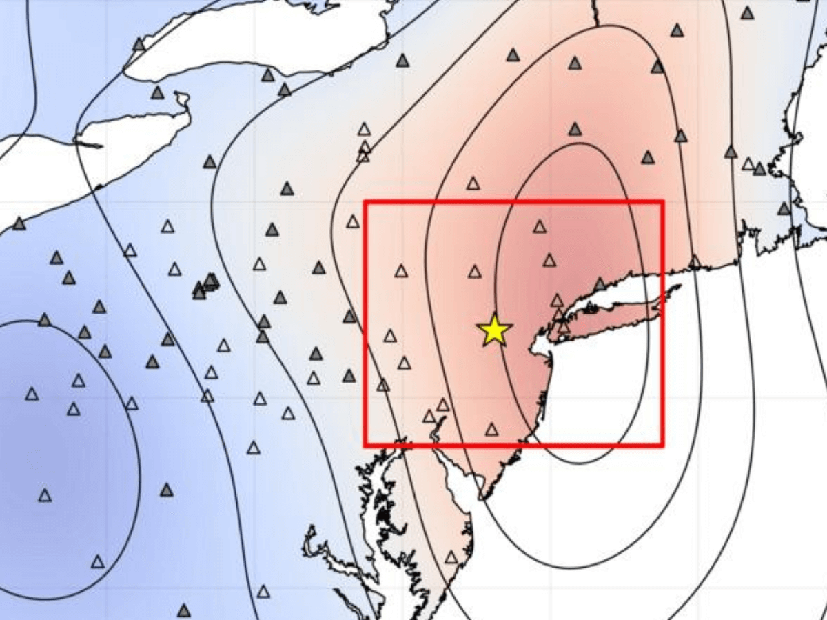
Peak ground velocity from a magnitude 4.8 earthquake under Tewksbury township, N.J., (gold star) on April 5, 2024. Shaking was relatively weak at the epicenter, but spread unexpectedly far, predominantly to the northeast. (Credit: Won-Young Kim/Lamont-Doherty Earth Observatory)
NEW YORK — When a magnitude 4.8 earthquake struck Tewksbury, New Jersey on April 5, 2024, millions of residents across the northeastern United States felt the ground shake. However, something peculiar caught scientists’ attention: the earthquake’s energy didn’t spread out evenly in all directions as typically expected. Instead, it focused predominantly on New York City while producing surprisingly weak shaking near its origin point.
A new study reveals why this unusual pattern occurred: the earthquake’s rupture traveled downward and eastward through the Earth’s crust, directing most of its energy away from the surface near the epicenter and toward the Big Apple.
The earthquake was the region’s largest since 1900. While not considered major by global standards, it affected an estimated 42 million people across the northeastern United States, generating a record-breaking 183,000 reports to the U.S. Geological Survey’s “Did You Feel It?” system – the most ever recorded for any U.S. earthquake.
“We expected some property damage―chimneys knocked down, walls cracked or plaster fallen, but there were no obvious signs,” says Won-Young Kim of Columbia University’s Lamont-Doherty Earth Observatory, who co-authored the new study published in The Seismic Record. “We talked to police officers, but they were not very excited about it. Like nothing happened. It was a surprising response for a magnitude 4.8 earthquake.”
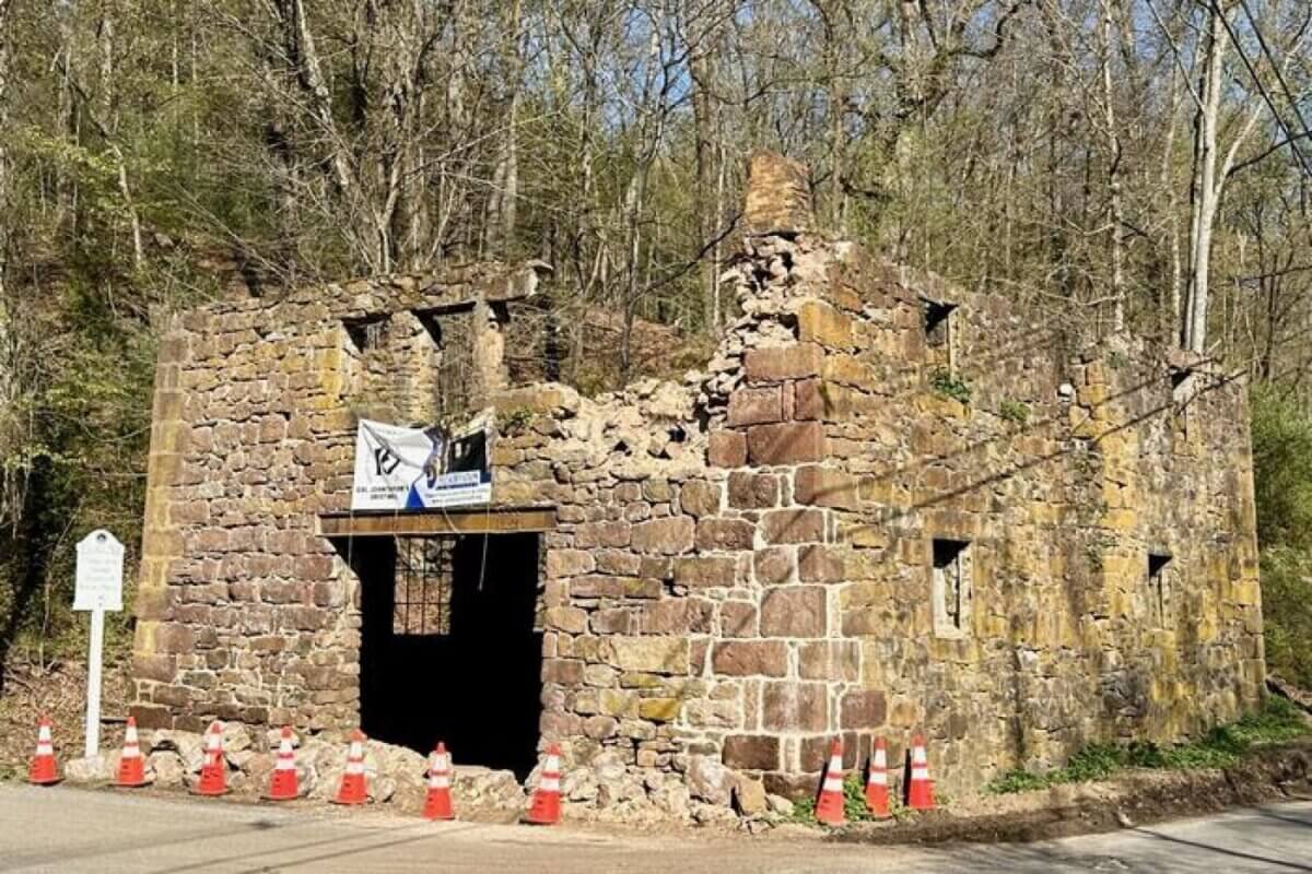
This lack of damage near the epicenter puzzled scientists. Based on existing models, an area within 10 kilometers of the earthquake’s center should have experienced “very strong” shaking – enough to potentially collapse unreinforced masonry walls and chimneys. Instead, damage was mostly limited to minor wall cracks and items falling from shelves. The only significant damage near the epicenter was to an already deteriorating 18th-century grist mill about 3.5 miles away.
Meanwhile, more substantial effects were felt at much greater distances, particularly toward the northeast. In Newark, about 20 miles away, three-row houses partially collapsed. New York City, 40-50 miles from the epicenter, saw more than 150 buildings report damage, mainly superficial cracks. Two buildings in the Bronx required protective sidewalk scaffolding, and a Brooklyn school had to close its gymnasium due to structural concerns. The effects extended even further – gas and water lines leaked in the Hudson Valley, a sinkhole opened on Long Island, and people as far away as New Hampshire (280 miles distant) reported feeling the earthquake.
To understand this unusual pattern, researchers analyzed special seismic waves called Lg waves – low-frequency energy that bounces between Earth’s surface and a deep boundary called the Moho, which separates Earth’s crust from its mantle. This analysis revealed that the earthquake occurred on a previously unknown fault running north-south and tilting eastward at a 45-degree angle.
The earthquake’s rupture behavior was unique. Instead of sending most of its energy straight up to the surface, as typically happens, the rupture traveled downward along the tilted fault plane. When this energy hit the Moho, about 35 kilometers down (nearly 22 miles underground), it bounced back up – emerging right under New York City. This pattern of bouncing continued, creating echoes that reached into New England before gradually weakening.
This finding helps explain why the earthquake’s effects were so widely felt despite its moderate size. The hard, dense rocks underlying the northeastern United States efficiently conducted this energy, similar to how a bell rings when struck. Think of it like skipping a stone across the water – the stone (seismic energy) bounces multiple times, creating impacts (ground shaking) far from its starting point.
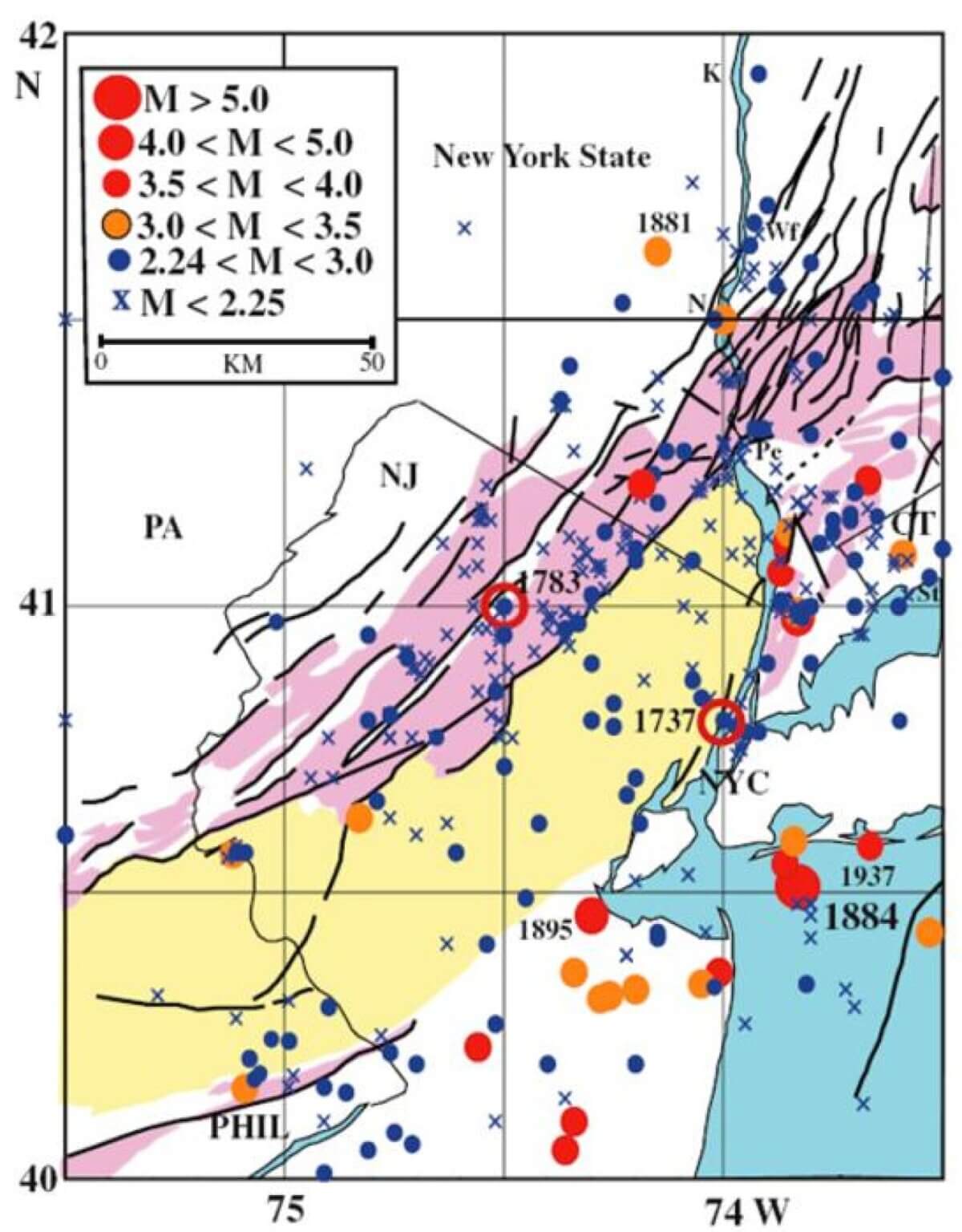
The study has important implications for understanding earthquake hazards in the northeastern United States. While most earthquakes in the region are too small to be felt, they occur along ancient fault zones created some 200 million years ago when North America separated from Europe. These old faults occasionally adjust themselves, causing earthquakes.
Historical records suggest that earthquakes of this size occur roughly every century in the region. However, some scientists believe larger earthquakes are possible – potentially up to magnitude 6 every 700 years or magnitude 7 every 3,400 years. Given that a magnitude 6 earthquake is 10 times more powerful than a magnitude 5, and a magnitude 7 is a hundred times more powerful, such an event could be catastrophic for the region’s densely populated areas.
“If [the April] earthquake was just a little stronger, or a little closer to New York City, the effect would be much greater,” says Kim. “We need to understand this phenomenon and its implications for ground motion prediction.”
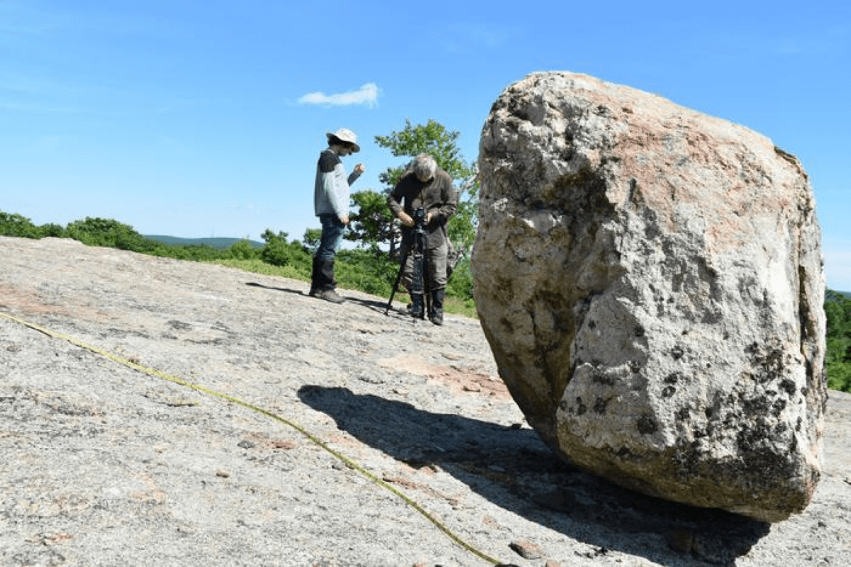
The research has sparked new investigations. Scientists have deployed dozens of temporary seismometers near the epicenter to monitor aftershocks, which could help better map the area’s fault systems. Other researchers are studying ancient rock fractures and even using precariously balanced boulders left by glaciers to understand the region’s earthquake history.
Paper Summary
Methodology
The researchers used two complementary approaches to study the earthquake. They analyzed Lg waves, which are seismic waves that bounce between Earth’s surface and the Moho boundary, comparing the main earthquake with its largest aftershock to understand the earthquake’s behavior. They also created detailed computer models to determine how the fault moved during the earthquake, testing different scenarios until they found one that matched the observed pattern of ground shaking across the region.
Key Results
The analysis showed that the earthquake occurred on a previously unknown fault oriented north-south and dipping eastward at 45 degrees. The rupture covered a circular area about 2.2 kilometers in diameter, traveling downward and eastward at 1.87 kilometers per second. This unusual rupture pattern directed most of the earthquake’s energy away from the surface near the epicenter, instead channeling it toward the northeast where it affected more distant areas like New York City more strongly than expected.
Study Limitations
The study was limited by the sparse network of seismic monitoring stations in the region – only four stations within 100 kilometers of the earthquake. This meant researchers had to rely more heavily on data from distant stations. The lack of visible surface rupture or detailed local geological data also made it challenging to definitively identify the specific fault responsible for the earthquake.
Discussion & Takeaways
This research reveals that earthquakes in the northeastern United States may behave differently than previously thought, with implications for seismic hazard assessment in the region. The study shows how earthquake energy can be channeled in unexpected ways, potentially causing more damage in distant population centers than near the epicenter. This information could be valuable for updating building codes and emergency preparedness plans in the region.
Funding & Disclosures
The research was supported by the National Research Foundation of Korea and the Consortium for Monitoring, Technology, and Verification under the Department of Energy National Nuclear Security Administration. The authors declared no conflicts of interest.


