(Credit: Andreas Gäbler on Unsplash)
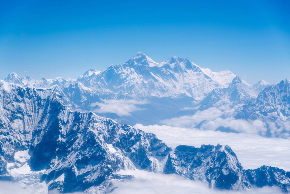
LONDON — Mount Everest has been the tallest mountain in the world, likely for millions of years, but a groundbreaking study has uncovered a surprising reason why it’s getting even taller. The world’s highest peak already stands at an impressive 29,032 feet above sea level. Now, scientists propose that a dramatic change in river patterns has given this iconic mountain an extra boost, making it even taller than its Himalayan neighbors.
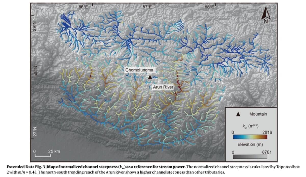
The study, published in Nature Geoscience, reveals how a process called “river capture” has reshaped the landscape around Mount Everest — also known as Chomolungma or Sagarmāthā — over the past 89,000 years. This geological phenomenon occurs when one river diverts the flow of another, effectively stealing its water and expanding its drainage area. In this case, the Arun River, a major tributary of the Kosi River system, captured a significant portion of water that once flowed elsewhere.
This river heist set off a chain reaction in the region’s geography. With more water flowing through it, the Arun River began to cut deeper into the landscape, carving out a massive gorge. As the river eroded the land, it triggered a counterintuitive effect: the surrounding mountains, including Mount Everest, started to rise even higher.
“Mount Everest is a remarkable mountain of myth and legend and it’s still growing. Our research shows that as the nearby river system cuts deeper, the loss of material is causing the mountain to spring further upwards,” says study co-author and PhD student Adam Smith from University College London in a media release.
The reason for this uplift lies in the principle of isostasy, which describes how Earth’s crust floats on the denser mantle below. When a large amount of rock is removed from one area, the crust rebounds upward, similar to how a boat rises in the water when cargo is removed. In the case of Mount Everest, as the Arun River carved away at the landscape, the surrounding peaks experienced a modest but measurable uplift.
Using sophisticated computer models, the research team estimated that this process has added between 15 to 50 meters (49 to 164 feet) to Mount Everest’s height over the past 89,000 years. This may seem small compared to the mountain’s total height, but it helps explain why Everest stands noticeably taller than neighboring peaks in the Himalayas.
“We can see them growing by about two millimeters a year using GPS instruments and now we have a better understanding of what’s driving it,” notes study co-author Dr. Matthew Fox of UCL Earth Sciences.
The study also sheds light on the dynamic nature of Earth’s surface. Far from being static, our planet’s topography is constantly changing due to the interplay of various geological forces. In the case of the Himalayas, the ongoing collision between the Indian and Eurasian tectonic plates is the primary driver of mountain building. However, this new research highlights how other factors, such as river systems, can play a significant role in shaping the world’s highest peaks.
“The changing height of Mount Everest really highlights the dynamic nature of the Earth’s surface,” adds lead author Dr. Xu Han of China University of Geosciences, who carried out the work while on a China Scholarship Council research visit to UCL.
The findings have implications beyond just understanding Mount Everest’s height. They provide insights into how landscapes evolve over time and how different Earth processes interact. This knowledge is crucial for predicting how mountainous regions might change in the future, which has implications for local ecosystems, water resources, and even natural hazards like landslides.
Paper Summary
Methodology
The researchers used a combination of computer modeling and analysis of digital elevation models (DEMs) to reconstruct the history of river capture in the Kosi River basin. They employed a stream power model, which simulates how rivers erode landscapes over time based on factors like water flow and rock strength. By adjusting parameters in this model and comparing the results to the actual topography of the region, the team was able to estimate when the river capture event occurred and how it affected the surrounding landscape.
Key Results
The study found that the Arun River likely captured additional drainage area about 89,000 years ago. This event led to increased erosion rates in the river gorge, ranging from 5-10 mm per year in the upper reaches to less than 1 mm per year in the lower areas. The resulting isostatic rebound is estimated to have lifted Mount Everest by 15-50 meters, contributing to its anomalous height compared to neighboring peaks.
Study Limitations
The research relies heavily on computer models and assumptions about past conditions, which introduces some uncertainty. The exact timing of the river capture event and the precise amount of uplift are estimates based on the best available data and models. Additionally, the study does not account for all possible factors that might influence mountain height, such as variations in local tectonics or climate-driven erosion patterns.
Discussion & Takeaways
The study highlights the complex interplay between different geological processes in shaping Earth’s surface. It demonstrates that even subtle changes in river systems can have significant long-term effects on topography. The research also emphasizes the importance of considering multiple factors when studying landscape evolution, rather than focusing solely on large-scale tectonic processes.
Funding & Disclosures
The research was supported by grants from the National Natural Science Foundation of China, the Second Tibetan Plateau Scientific Expedition and Research Program, and the Fundamental Research Funds for the Central Universities. Additional funding came from the Jiangsu Innovation Support Plan for International Science and Technology Cooperation Program and the UK Natural Environment Research Council. The authors declared no competing interests.


Back in the 1970s I wrote a paper in Geology class with the conclusion that Everst was growing at a rate of one inch every 100years. This was before computers . So with the amount is sea floor spreading and a few other calculations I made the conclusion. I got an A on the paler but the instructor added on the back page in red ink.”You forgot to calculate for erosion.”