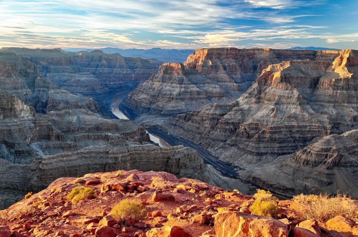
The Grand Canyon (Photo by Omer Nezih Gerek on Unsplash)
A Colossal Cliff System May Explain One of the Grand Canyon’s Biggest Mysteries
In A Nutshell
- A new study proposes that a colossal, long-lived cliff system once ran along the edge of ancient North America, helping explain a 1.2 billion year gap in the Grand Canyon’s rock record.
- Computer models show this “Great Escarpment of Laurentia” could account for the uneven, multi-kilometer erosion patterns seen in the canyon’s deep rock layers.
- The escarpment’s position lines up with where similar giant cliffs sit today along the coastlines of Africa and Brazil, and it may have stretched inland as far as Texas, Oklahoma and Missouri.
- Researchers argue the cliff also set the stage for ancient glaciers to carve even deeper, and later held back rising seas for tens of millions of years.
Few places on Earth stop people in their tracks like the Grand Canyon. At its rim, visitors peer down into a mile of exposed rock, a layered record of nearly two billion years of Earth’s history. But geologists have long been puzzled by something invisible to the naked eye: a massive gap in that record, roughly 1.2 billion years of missing time at a single buried surface, as if someone tore out more than half a book. Now, a new study argues that a colossal cliff system, one that may have stretched across a huge swath of ancient North America, is the long-missing explanation.
That mysterious gap is known as the Great Unconformity, a surface where basement rocks more than a billion years old sit directly beneath much younger sediments with almost no transition between them. Filling in that gap required stripping away roughly 10 kilometers, about six miles, of rock. For decades, researchers have debated why, with some blaming ancient glaciers from a period called “Snowball Earth” and others pointing to forces tied to the breakup of an ancient supercontinent called Rodinia. A team of researchers now argues both forces were at work, connected by a giant, long-lived cliff system that made the glaciers’ job easier once they arrived.
A Breaking Continent Left Behind a Towering Cliff
According to the study, published in the journal Geology, the team modeled a massive escarpment, essentially a towering cliff along a continental rift edge, that they argue once rimmed much of what is now North America. Calling it the “Great Escarpment of Laurentia,” after the ancient precursor of the continent, the researchers conjecture it formed roughly 800 to 750 million years ago, as Rodinia began splitting apart. That split separated what would become North America from Australia, and along the new edge, a rift fault formed while the landscape heaved upward on one side, producing an escarpment similar in scale to the coastal cliffs of southern Africa and eastern Brazil today.
Using computer simulations of erosion, the team modeled how such an escarpment would behave over 200 million years. The models produced a steep cliff flanked by a plateau on one side and a lower basin on the other, retreating inland as rivers carved into it from below. The best estimate model produced about 5 kilometers of erosion near the escarpment, while some scenarios exceeded 8 kilometers. Farther away, at 200 kilometers or more, total erosion dropped to 2 kilometers or less.
That uneven erosion matters because it lines up with the rock record. A technique tracking how long minerals sat buried at certain underground temperatures has produced independent Grand Canyon evidence interpreted as more than 6 kilometers of rock removal over roughly 200 million years, closely fitting the model. Sustained erosion like that, the authors argue, points to a persistent feature rather than a single catastrophic event.

The Grand Canyon Sat Where Africa’s Escarpments Sit Today
Reconstructing Laurentia’s geography around 717 million years ago, the researchers found the Grand Canyon sat about as far inland from the ancient coastline as today’s great escarpments in Africa and Brazil sit from their coastlines now. Death Valley fits the same pattern, appearing to have sat within the lower basin bounded by the escarpment, consistent with the thick glacial sediment it preserves in a rapidly sinking basin that received large amounts of material from nearby highlands.
Beyond the Southwest, the escarpment may have reached toward Texas, Oklahoma and Missouri, hinting it stretched deep inland rather than staying confined to the West.
When the Glaciers Arrived, the Cliff Was Ready
The escarpment, the authors say, would have made a ready made target once the ice showed up. A 1 to 2 kilometer high cliff, already shedding rock through river erosion, would have been especially vulnerable once global temperatures plummeted. Glaciers would not have needed to create the erosion from scratch; they would have amplified it, a pattern the authors compare to Antarctica’s Dronning Maud Land Mountains, where most of 8 to 10 kilometers of erosion occurred before glaciers ever arrived.
Timing offers another clue. A Grand Canyon sandstone layer dated to about 508 million years ago records a marine flooding event that came roughly 127 million years after a major glacial retreat. The escarpment, according to the study, would have acted as a barrier keeping the sea at bay, and only once erosion had worn it down did rising sea levels finally overtop it.
For anyone who has stood at the Grand Canyon’s rim and wondered how such emptiness in the rock record came to exist, this study offers a physical answer. Modern escarpments in Africa and South America have stayed active for more than 130 million years, and if the Laurentian version behaved the same way, a continent scale cliff born from a supercontinent tearing itself apart spent hundreds of millions of years wearing itself down, writing one of the most dramatic chapters in North American geological history.
Paper Notes
Limitations
The study relies on landscape evolution models that simulate erosion over 200 million year timescales using simplified two dimensional representations of rift generated topography. While the model outputs are compared against independent geological data, including existing temperature based erosion estimates from the Grand Canyon region, the models involve assumptions about initial topography, geothermal gradients, and erosion rates that carry inherent uncertainties. The authors acknowledge that the proposed escarpment’s geometry would have been segmented and locally disrupted by rivers, and that rifting along the margin was gradual and diachronous rather than a single event, adding further complexity that the models approximate rather than fully capture. The study also draws comparisons to much younger Mesozoic era escarpments, and whether those analogies fully apply to Neoproterozoic conditions remains an open question. Importantly, the Great Escarpment of Laurentia itself is a reconstructed feature rather than a directly observed one; its precise path, shape, and continuity are inferred from models and comparisons with younger escarpments, not measured directly in the rock.
Funding and Disclosures
The acknowledgments section of the paper thanks the WoodNext Foundation, described as a fund of a donor advised fund program. No other specific grant numbers or funding agencies are identified in the provided content.
Publication Details
Paper Title: Exhumation of Grand Canyon’s basement along the Great Escarpment of Laurentia | Authors: Thomas M. Gernon, Thea K. Hincks, Elias J. Rugen, Sascha Brune, Jean Braun, and Stephen Marshak | Author Affiliations: School of Ocean & Earth Science, University of Southampton, UK; GFZ Helmholtz Centre for Geosciences, Potsdam, Germany; Institute of Geosciences, University of Potsdam, Germany; Department of Earth Science and Environmental Change, University of Illinois Urbana–Champaign, USA | Journal: Geology (Geological Society of America) | DOI: https://doi.org/10.1130/G55133.1 | Manuscript Received: February 9, 2026; Revised July 8, 2026; Accepted July 20, 2026; Published Online August 17, 2026 | Open Access: Published under a CC-BY license (Gold Open Access)


